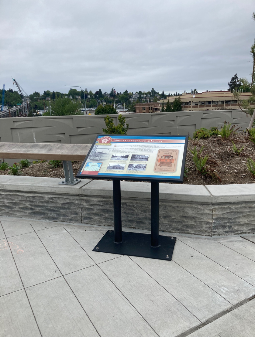
New Montlake Historic Signs
The six Montlake Historic District interpretive signs were developed as mitigation for effects to the neighborhood as a result of the SR 520 Project. This mitigation was determined as part of the Programmatic Agreement documenting ways WSDOT would avoid, minimize, and mitigate for effects to historic properties under Section 106 of the National Historic Preservation Act.
The signs were developed by WSDOT in collaboration with members of the community and Section 106 concurring parties, as well as with agency partners at the City of Seattle. We used another mitigation measure, the nomination of the neighborhood as a historic district to be listed on the National Register of Historic Places (NRHP), to determine the topics for the interpretive signs.
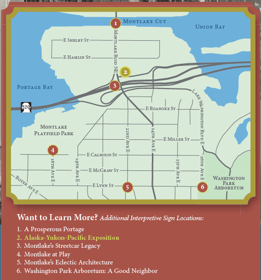
There are also 2 interpretive signs on both the Montlake and Roanoke lids that share information about the larger connections to the landscape and not just tied to the neighborhoods.
Other mitigation measures for the broader community around Montlake includes documenting the floating homes on Portage Bay, documentation and listing Olmsted Boulevards and Parks to the NRHP, and converting historic property documentation for consistency across different agency’s databases.
We are also in the process of developing 7 interpretive signs sharing details about the historical and ongoing importance of the area to local Tribes- once fabricated, these signs will be installed from the Graham visitor center up to the Union Bay Natural Area and will cover topics from traditional uses of native plants, to important local animal species and the effects of historic development on the natural habitat of this significant area.